(written on April 2nd pm from notes)
Late night, late morning (out just after 11:00). 🙃
As I pulled out of the parking area, onto the road, and started going over the bridge, I looked at the river below and…
Holy…
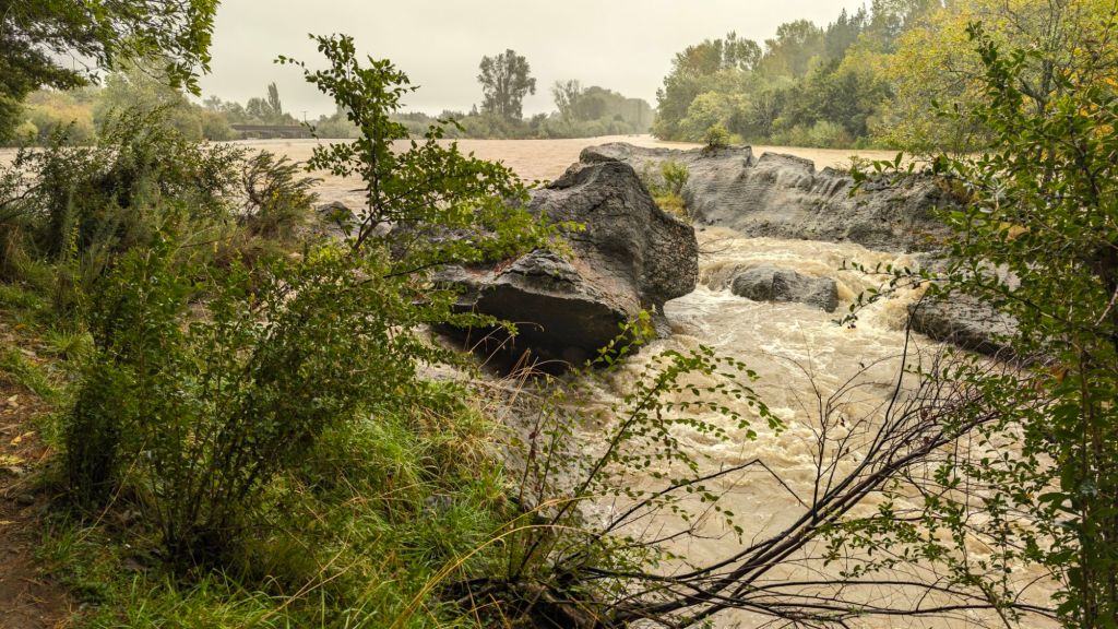
The river was absolutely raging. What had been a gentle flow with lots of exposed wash everywhere (far more wash than water) with the normal, gentle micro rapids as the river descended, was now a bank-to-bank, raging monster.
It must have rained so much more than I ever guessed. Of course, I had my headphones in all night, so I wouldn’t have heard a thing.
But… wow.
That awe compounded when, driving over the bridge at Paines Ford, the entire river, bank to bank, was an even more impressive spectacle.
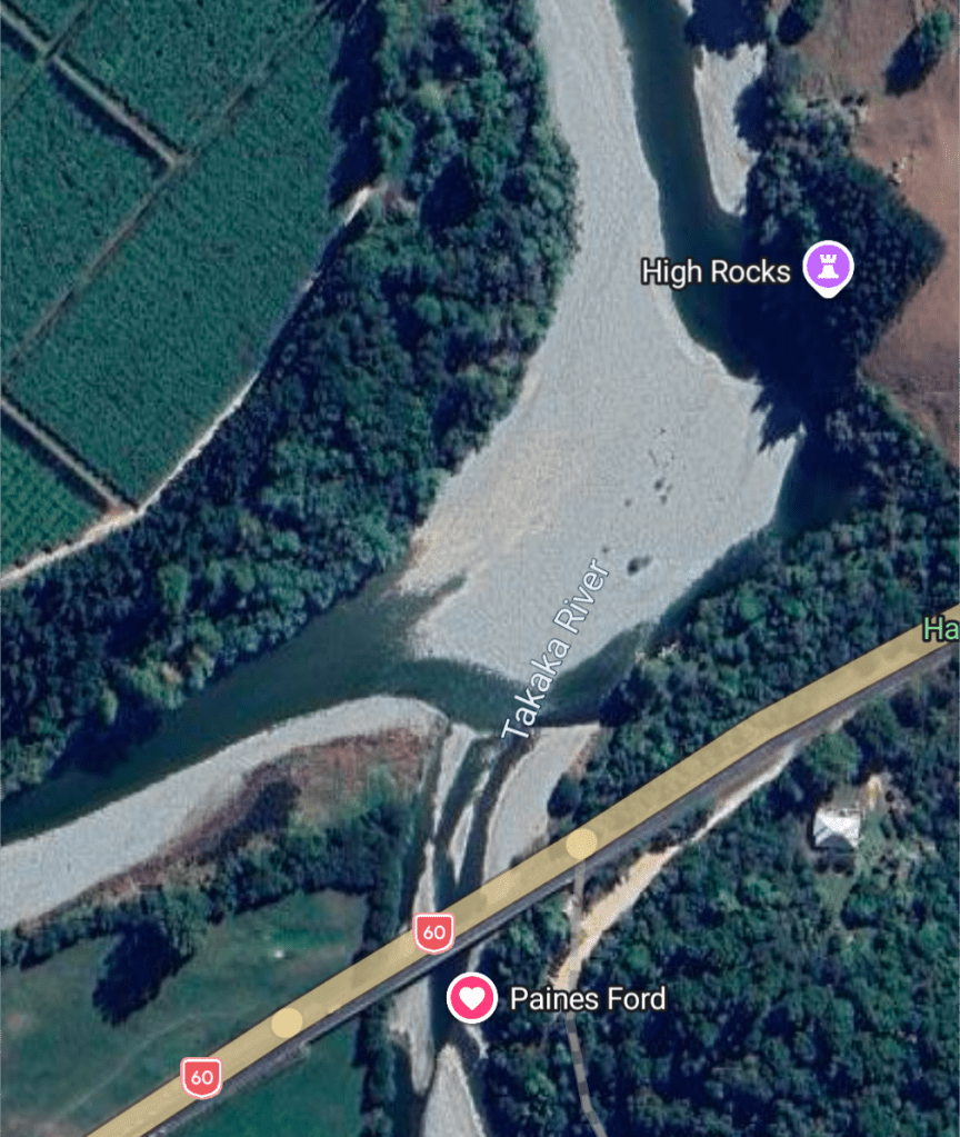
I don’t know how far across the river channel is from bank to bank. My beloved Paines Ford adventure spot is just barely down river from the confluence of Waingaro and Tākaka rivers, and it’s wider at the confluence and narrows a little bit where the jumping and climbing cliffs are.
My best guess, making rough calculations by looking at the satellite view from Google Maps, is that the river is probably about 350 ft wide just after the confluence, increases to maybe 450 get wide quite quickly, and than narrows to about 300 ft wide where the cliff jumping spot is.
Whatever it is, it’s a loooong way from one bank to the other, and the whole thing was filled and raging.
Here’s the current satellite view on Google Maps. Not sure how long ago the image was taken, but it at least gives some perspective of the confluence, the widening, the narrowing, and the relative amount of water in the riverbed. 🙃
I pulled my van around into the parking dirt parking lot of Paines Ford, pulling right up in front of the bridge.
What I saw there was stunning and began really putting into perspective what I was looking at.
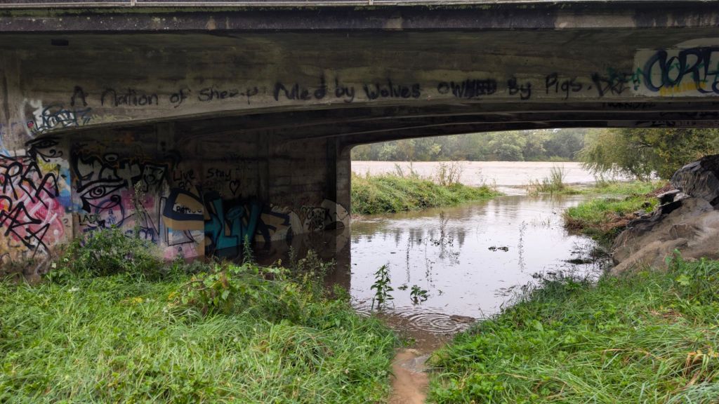
That’s only a few inches from entering the parking lot itself! 😶
I took pictures and then started my little exploration adventure, wading across the flooded portion under the bridge, and finding my way over to the narrow dirt path through the bush toward the cliffs.
There was certainly no way to follow the path and stay dry. The path had turned into a small river in places and part of the larger river in other places.
Walking along the path, I spotted an eel that had escaped the muddy churn of the larger river, and had joined me in the clear water of the walking trail. 😆
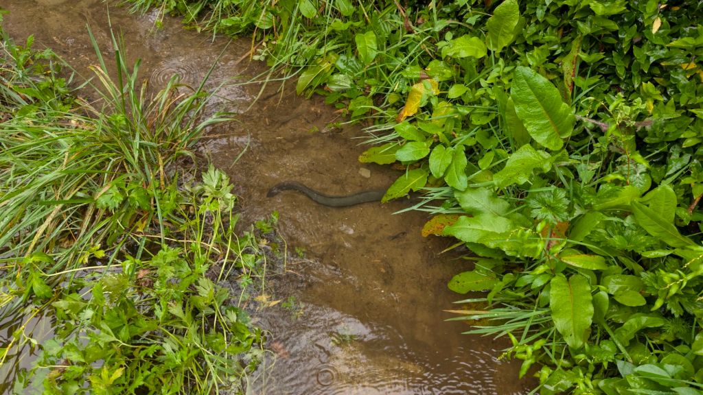
I watched it disappear into the vegetation on the side, and I worried a little bit that it might end up getting stuck there when the water receded.
But I think I remembered that eels can cross, surviving out of water, in order to find hunting grounds. (And yes, a quick Google, if it’s correct, says that eels are highly adapted to survive out of water, being able to breathe through their skin. They are also skilled climbers, with reports of them being able to climb near-vertical waterfalls that are well over 100 ft tall. 😶)
As I continued along, the water got deeper and deeper in what had previously been a trail well above river level. Once the water reached chest level (don’t worry, there was no current, as I was way up on the side in the bush), I realized I was going to need to choose a different route to the cliffs. 🙃
Though the water was only chest deep, and there wasn’t any danger from strong currents, I had yet to even arrive at the part of the trail that abruptly drops down perhaps another five-plus feet into a little draw that itself is still normally perhaps another couple of feet above the normal river level. 🙃
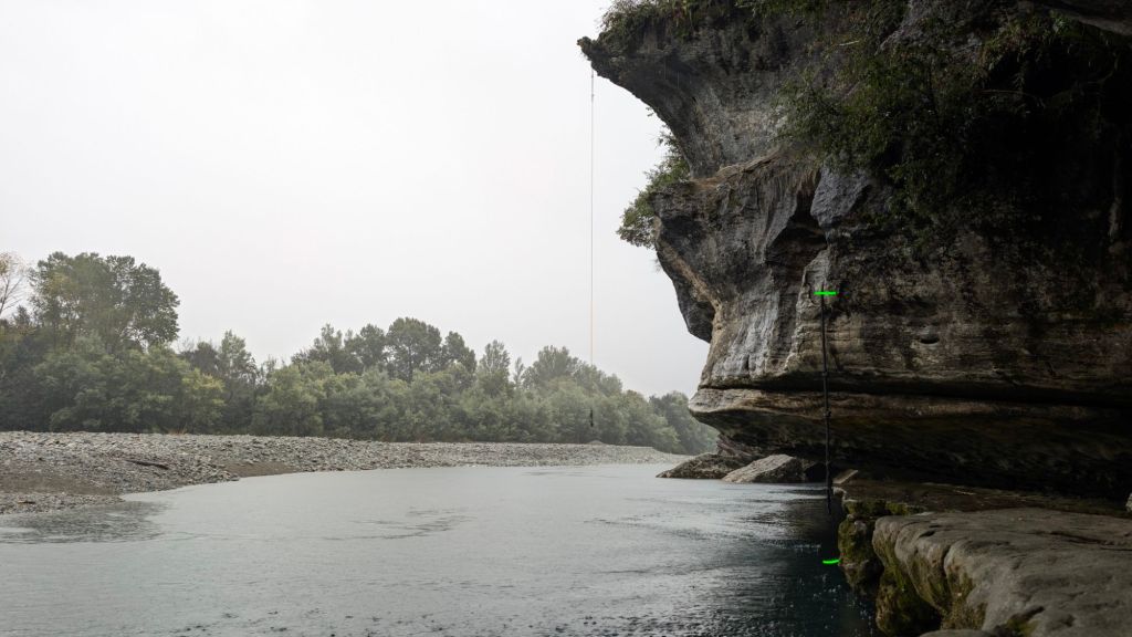
Here are some pictures to give you a better idea of the difference from yesterday to today.
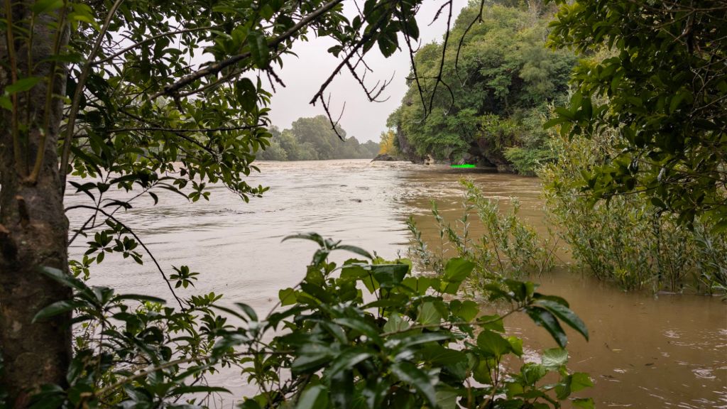
You see that bright green line indicating current water level?
In this next picture, the lower green line is where the water level was yesterday, and the upper green line is where it is today.
😶
Clearly, my best chance at getting to the cliffs heading further inland to higher ground and then going around, so I wandered into the bush further, until I found myself standing on wet, but not flooded, ground. From there, I found my way across one ditch, tried to wade across another, which seemed fine until my next step abruptly dropped me down to chest level. 😅
Gratefully, I was able to climb out of there and then find my way around to unflooded terrain again and back to the walking path that leads to the cliff tops.
And wow. What a view from the cliff tops!
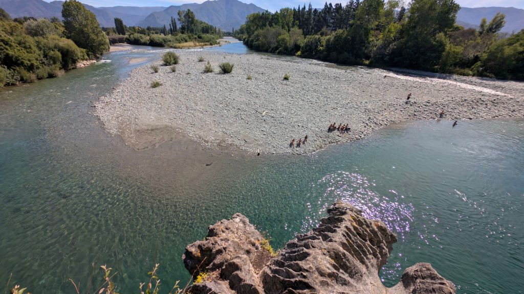
Do you remember what it looks like normally? Here’s a reminder from January (I didn’t take a picture from here yesterday, unfortunately).
Aaaaaaand here’s today.
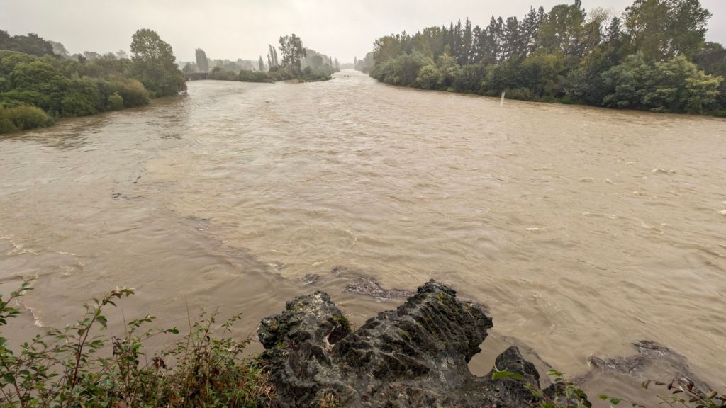
Looking at the water levels compared to what I remembered from yesterday, and contemplating my experience in the water from just a few minutes ago (chest deep above the little draw, maybe five feet from that level down to the bottom of the draw, plus maybe another two feet from that spot down to the river’s edge) best guess was that the water was 10 to 12 ft above what it was yesterday. 😶
Considering the sizable width of the river, there was an absolutely enormous volume of water flowing through there today.
Holy. Freaking. Crap.
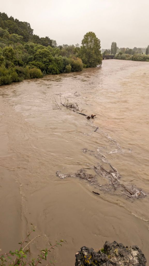
I sat there perched on my favorite little spot, legs dangling over the cliffs, just taking in the view, vegetative debris of all kinds, from leaves all the way up to entire trees washing down river.
Wow. 🙃
Though a little sketchy, I made the scramble down the little draw between cliff tops that takes you to where the rope swing is.
It was crazy to see the water level of the river right about at the point where most people jump off the cliff with the rope swing.
After scrambling back up, I decided to wander down to where the other rope swing is, and once there, I stood marveling.
What had one spin large boulders towering above the river below were now mostly completely covered in water, the gaps between the exposed portions now forming rushing rapids.
🤯
So cool! 🙃
Since I was already over there, I decided to wander downriver to see if I could find the other cliffs that people jump from that I’ve seen in pictures.
I followed the narrow path until it started running down by a fence toward the river. With the river level being as high as it was, the rest of the path to the other cliff-jumping spot was underwater. 🙃
Oh well.
Next time I go to New Zealand, I’ll give it a look again. 😊
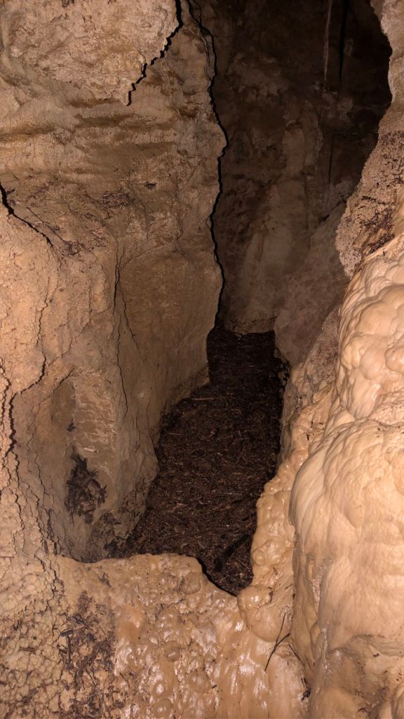
As I made the little scramble up the hillside to go back to the cliff tops that I like to hang out at, I passed by the little cave that I’ve seen before but haven’t really explored. I don’t think I’ve ever done much more than just stand at the entrance and peer in.
So I figured I might as well give it some time, since I was there and not doing anything else. 🙃
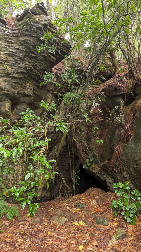
So in I went, phone flashlight on, descending bit by bit.
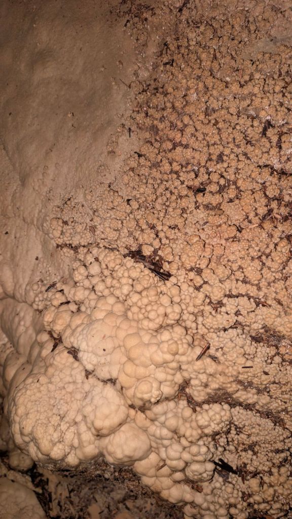
I had thought that it was just going to be a little tiny cave, maybe 10 or 15 ft back, but it kept going! Deeper and deeper and further down I went.
To my surprise and delight, I saw a cave weta, mineral formations, and even a handful of glow worms. 😁
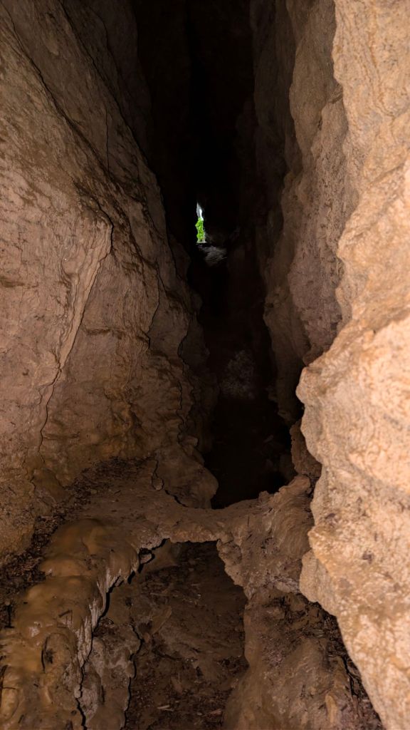
Toward what appeared to be the end of the navigable cave, the very last bit that I could reach was underwater, and not just underwater, but breathing water.
Clearly, the water that was in the cave was coming from the overflowing river, which meant somewhere down below there was a connection with the cave– the only question being how big was the passageway that allowed the water to come in? Was it just cracks in the rock? Or small passageways that perhaps fish could swim through? Or was there a passageway big enough that a human could squeeze through?
With the water there, there wasn’t really any way to tell today, but it’s an intriguing question for me. 🙃
As I climbed the rest of the way back up the hill to the cliff tops and then back down the other side, I heard voices of a couple of younger guys. Though I was unable to see them, I could tell that they were wading their way through the water just as I had.
I called over to them, and they replied back. To my great surprise, one of them said, “Stephen?”
😶
Wait, what?
I said yes, figuring that maybe one of the rock climbers I had met a couple of months ago was still there or was there again and had recognized my van and remembered my name. 🙃
Whoever it was, I let them know that they weren’t going to be able to get across to where I was. I followed my dry-land route back to the other side of the draw and found that they had left gum boots at the water’s edge, but I still couldn’t see them.
Not seeing them, I wandered all the way back around the draw to the far side again. I still didn’t see them, but after trying to get pictures of where Acid Test is supposed to be, they wanted to go to the cliff tops to be able to look down on the river as I had.
So I walked around the draw yet again, met them in the unflooded portion of the woods, and helped them find their way over to the trail.
It was kind of funny, their calling out my name turned out to be a complete coincidence: They (a couple of teenagers, by the looks of it, though they were staying for a fairly extended period at the rock climbing place, so they probably had to have at least graduated high school?) had met somebody named Stephen at the rock-climbers campground just across the road from there, and when they heard somebody wandering in the woods by the cliffs, they figured it was that person, so when they called out my name with a questioning inflection, they were right!
Ish. 🙃
Anyway, I guided them over to the top of the cliff, so they could take in the awesome vista.
They took pictures, and we chatted for a little bit, talking about the flood, and jumping from the overhang into the river and what not. Though the flow of the river was super high compared to normal, it wasn’t such that it felt dangerous were someone to fall or jump in.
That might sound funny, but it wasn’t the kind of crazy water that had a massive current that would suck you down and keep you from being able to swim to shore. No, it was a relatively placid river, just an absolutely enormous volume of water.
The only place that gave me pause was over by the second rope swing. I knew the shapes of the massive buried boulders under the water there, so I knew that there could be underwater currents going through the gaps between the boulders. I still don’t think serious danger was likely, at that point, but it was concerning enough to give me pause and enough that I certainly wouldn’t attempt jumping in there.
As long as you got past that point, I think you’d be golden, as it would just be a normal swim from the middle of a river to shore. 🙃
Aaaanyway, after taking in the sites, I showed them the shortcut that I had found that exits the woods pretty much right across the road from their campground.
Not really much of a surprise, since so many rock climbers go to those cliffs for some deep-water bouldering fun. 🙂
Walking back to my van, I took note of the water level, taking a picture, and then hanging out in my van for maybe another hourish?
The rain had pretty much stopped, and I wanted to see how long it took for the water to recede.
I texted back and forth with some family and friends. Eventually, with very little change in the water level, I decided to head north.
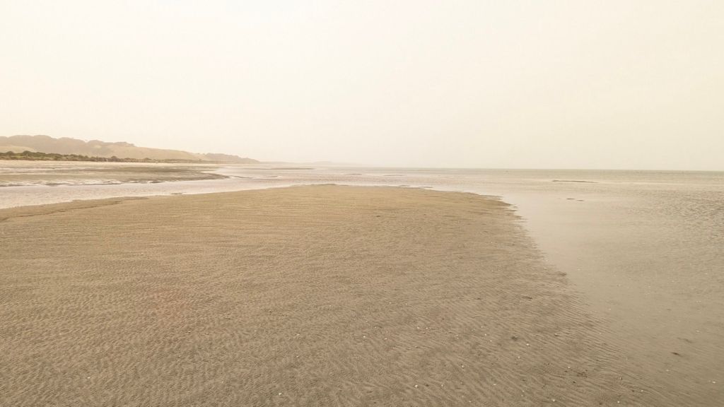
With the rivers flooding, I decided today was a good day to make my way back up the coast for a little reminiscing trip to Farewell spit and Cape Farewell.
On the way there, I stopped off to throw my fresh recyclables in the recycling bins, popped over to the grocery store to appease my sweet tooth again 😅, and then started driving North.
As I drove along, I gave my sister a video call, and I chatted with her and Hans for probably the next hour from the Waikoropupu Springs parking lot.
Hanging out for that long meant that I was going to have a whole lot less time up north, so I debated whether or not I should even try because I might be in a rush, but I decided to go ahead and head up north.
Before doing so, however, I decided to wander over to where the Springs bubble out of the ground to see if the rain storm had caused enough water to come down that it would muddy up the springs, but nope!
I guess when it takes potentially 100 years for the water to make its way from the surface to the springs, you’re not going to have any issues with muddy contamination. 🙃
It was bittersweet going back to Farewell Spit. That’s another area of New Zealand that feels a bit like home for me, great memories and sad memories. Incredible experiences. New friends.
Lots of nostalgia, even if the precipitating events were only two months ago.
[sigh]
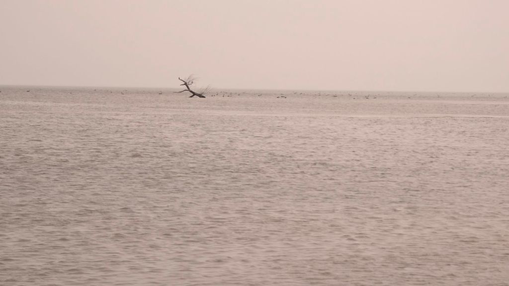
The tide was on its way in when I got there, high tide supposedly being something like 15 minutes away. Wanting to test the theory that I’d been told multiple times about the tide going out at the speed someone walks, parked my feet at the water’s edge, hoping to be able to be standing there when the water reached its peak and then started receding again.
Unfortunately, nothing seemed to change after high tide came and went, and I double-checked, and the first place that I had gotten my information from was actually incorrect. High tide was still an hour away. 🙃
Oh well.
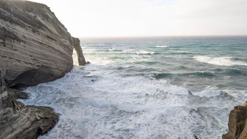
I didn’t really want to wait around for another hour to start the test, as the day was almost spent, so from there, I ventured over to the nearby Cape farewell, my third visit to that spot and second of this trip to New Zealand. 🙃
Like I said, nostalgia. 😊
I stopped by farewell spit one last time to check the tide. It was just a little bit after high tide when I got there, and little seemed to have changed at all with the level since I’d left an hour before high tide.
I didn’t notice the water level receding super quickly, so at least in this particular area, I don’t think the description I had been given about the speed at which it recedes was accurate.
It definitely recedes quickly, as I had participated in a whale rescue effort that was happening as the tide was going out, and I can certainly attest to the fact that if you’re not constantly moving the whale out to sea, you’re losing ground.
And maybe it just takes more time of being at high tide before the speed at which the water recedes increases significantly?
🤷
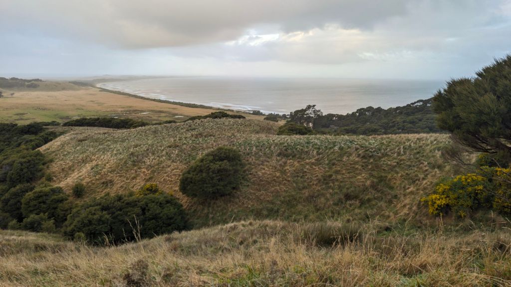
On my way out, I decided to take the time to climb a hill that overlooks the spit. Nick the Viking and I had hiked up one of the nearby hills, but I wanted to try climbing this one.
They’ve been in the middle of construction on the trail, building a predator barrier fence I think from one side of the spit to the other, I think, in the hopes of keeping possums and other predators off the spit.
Because of all the construction work, the path was a mud bog, so it was a little dicey trying to climb up without sliding through the mud.
Eventually, I made it as far as I wanted to go and snapped some pictures of the beautiful scenery.
On my drive back, I stopped once more at the Paines Ford parking lot to see how far the water had gone down, but it hadn’t gone down all that much…
I got back to Uruwhenua Reserve about 8:15, and called it a night, veging for a good long while before crashing.
What. A. Day.
Lift the world.
Bring it on.
~ stephen
